Atmospheric Conditions
Between the cruise departure on June 13 and until about June 22, weather conditions were typical of the Trade Winds regime, driven by the anticyclonic atmospheric circulation around the subtropical high pressure system (North Pacific High) that was centered in the northeastern Pacific. Meteorological conditions measured onboard R/V Revelle included easterly winds around 15 knots, while sea surface and air temperature (26.5 ºC and 24.5 ºC respectively at the start of the cruise) gradually decreased as we steamed eastward. We also observed predominantly cumulus clouds during the day.
Between June 26 and 28, measurements from the ship sensors indicated a gradual increase in atmospheric pressure and wind speed values falling down to 3 m/s. At that time, the ship’s track entered the southern edge of the North Pacific High. The low wind conditions combined with high daily shortwave radiation and reduced cloud cover led to intensified heating of the upper ocean as seen in higher sea surface temperature values. The calmest sea state of the cruise were observed during this period.
In early July, as the ship was entering its southeastern corner, the North Pacific High started moving west (as seen in weather forecast imagery from the www.PassageWeather.com, and kindly provided by Shuwen, the co-chief scientist from leg 1). The weather conditions we experienced were not tropical anymore, as the wind became more northerly while air relative humidity increased and stratus clouds became predominant. Sea surface and air temperature dropped to their coldest values of the cruise (17.5 ºC and 15 ºC respectively) near July 10. As the ship entered the shelf off California on July 12, warmer sea surface and air temperatures increased again.
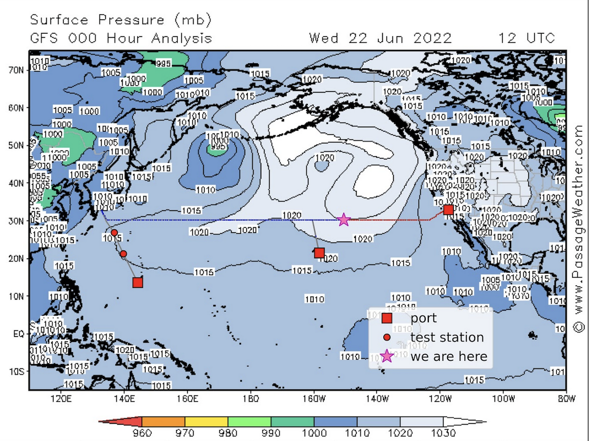
Pressure on June 22 2022 from the Global Forecast System (GFS) weather forecast model at the National Centers for Environmental Prediction (NCEP). Imagery provided from www.PassageWeather.com. Track of R/V Revelle during leg 2 (red line). Ship’s location on June 22 (pink star) is to the southwest of the North Pacific High anticyclone.
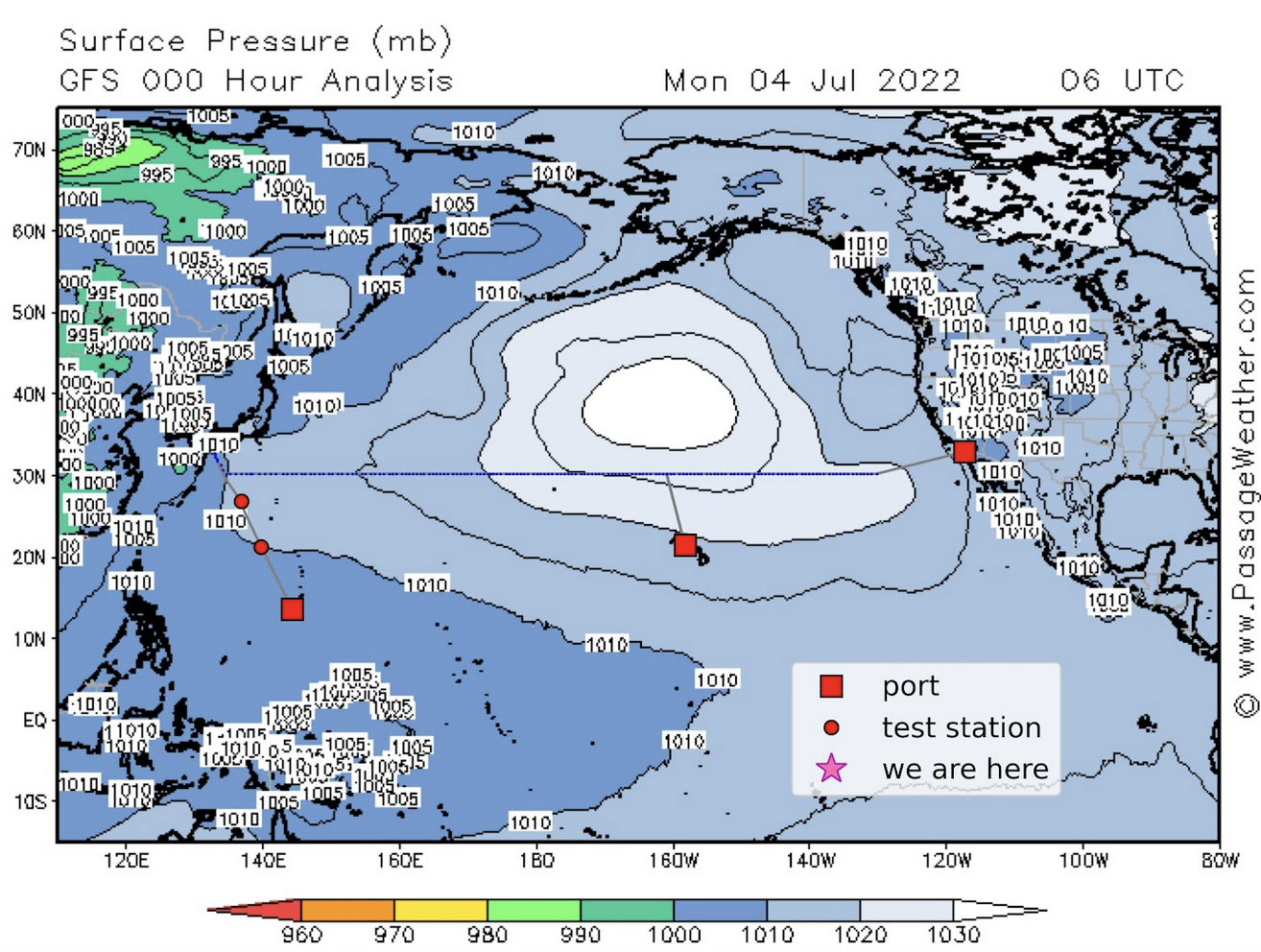
Same as figure above, but for July 4 2022. The North Pacific High has moved west.
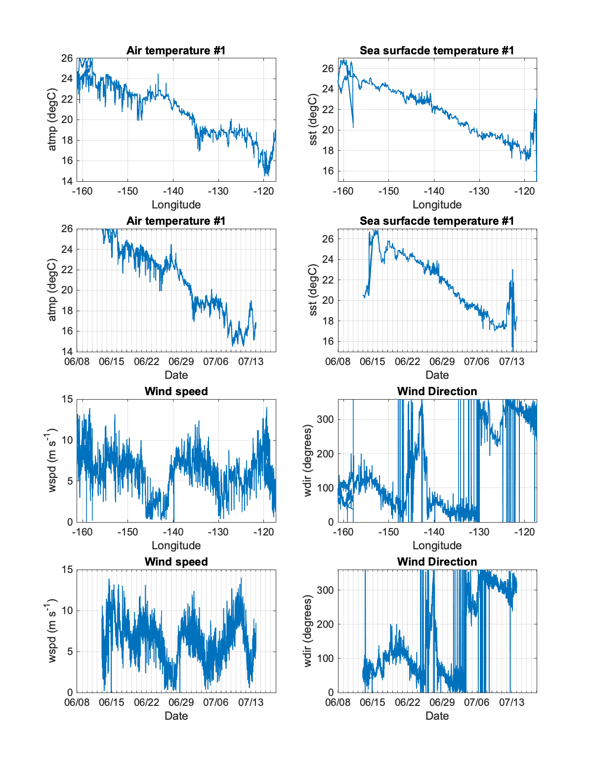
Meteorological measurements from R/V Revelle during GOSHIP P02 leg 2 in 2022, shown as function of longitude (top subplot) and time (bottom subplot). Air temperature (top left), sea surface temperature (top right), wind speed (bottom left), wind speed (bottom right).